Santa Maria Di Leuca
Info Santa Maria Leuca
-
Region:
Provincie:
Municipality:
CAP:
Area code:
Surface:
Population:
city hall:
-
Apulia
Lecce
Castrignano Del Capo
73040
0833
20,77 Kmq
5.368
Via Municipio 1
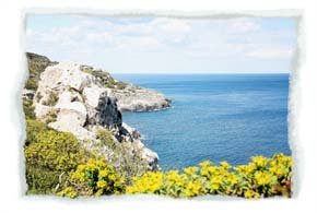
Santa Maria di Leuca is the farthest end of Salento
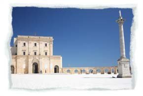
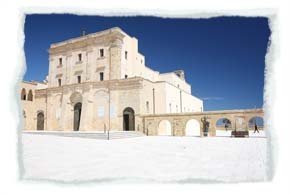
Romans called it “De Finibus Terrae”. Santa Maria di Leuca is the farthest end of Salento, the “heel” of Italy, point of contact between the Adriatic Sea and the Ionian Sea. On the top of the promontory, dominating the coast, stands the Basilica-Sanctuary of Santa Maria de Finibus Terrae, ancient place of pilgrimage: according to the tradition, the Marian devotion was inspired by St. Peter the Apostle, who visited this place travelling to Rome and changed the Pagan temple of Minerva into a Christian church.
It seems that the devotion to the Madonna already existed in 325, when the Virgin Mary saved a group of fishermen during a storm. The present fortified church was built between 1720 and 1755 to protect the Sanctuary from Saracen attacks. Next to the Sanctuary stands one the most important lighthouse of Italy: it is 48 metres high and stands at 102 metres above sea level; it has been put in action in 1866 by the civil genius. From the square you can enjoy an extraordinary view of the coast, the sea and the marine, which is connected with the Sanctuary by a monumental double flight of 300 steps. The work has been realized in 1939 during the Fascist twenty years, at the end of the works for the Apulian aqueduct; it is possible to admire an artificial waterfall between the two flights, which is opened only in particular occasions.
The charm of Leuca is also represented by its elegant villas, built between the 19th and the 20th centuries as holiday resorts for the Middle Class of Salento: it is worth mentioning Villa Meridiana, which was built in 1874 as first, and Villa Episcopo, which is similar to a Chinese pagoda. Every villa is characterized by a little church, a large garden and a “bagnarola” that is to say a ladies’ changing room: it gave them the possibility of having a bath without being seen.

