]]>

San Giovanni Rotondo

Info San G. Rotondo

  • Region:

    Provincie:

    Municipality:

    CAP:

    Area code:

    Surface:

    Population:

    city hall:

  • Apulia

    Foggia

    San Giovanni Rotondo

    71013

    0882

    261,88 Kmq

    27.506

    Piazza Dei Martiri 5

The story of this city is deeply linked with that of Father Pio from Pietrelcina

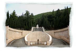
San Giovanni Rotondo lies in a valley, 600 metres in height, in the Gargano promontory and it is famous all over the world thanks to the charismatic Saint Pio from Pietrelcina, who draws thousands of believers.

San Giovanni Rotondo dates back to the 11th century when in a little village stood a round baptistery dedicated to San Giovanni, probably built on a previous temple dedicated to Giano. In the old town centre it is possible to visit the medieval church of Sant’Onofrio.

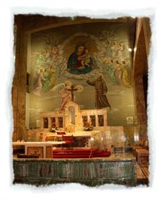
Nowadays the town is visited by a huge number of pilgrims devoted to Father Pio from Pietrelcina, recently declared a saint. The modern history of the town is deeply linked with the shrine of the friar with the stigmata, who spent here the greatest part of his life; he arrived in San Giovanni in 1916 and died here on the 23rd September 1968.

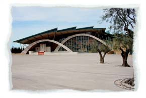
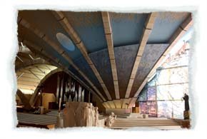
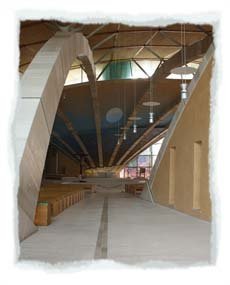
The new big shrine dedicated to Saint Pio has a big impact on the town view; it has been planned by the architect Renzo Piano and accommodates thousands of people. It has a surface of 6000 square meters and it is the second largest church in Italy after the Milan cathedral.

The church, consecrated in 2004 with a solemn celebration, has a spiral shape whose centre is the altar. The wide church courtyard, made of Apricena stone, joins the old shrine of Santa Maria della Grazie with the new one: they are ideally linked through a huge glass wall.

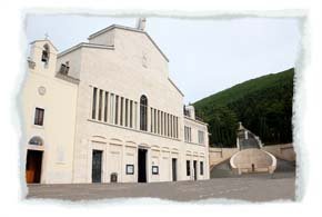
Recently Saint Pio’s mortal reminds have been moved from the old crypt to the new one, embellished by numerous mosaics realized by the monk and contemporary artist Marco Rupnik.

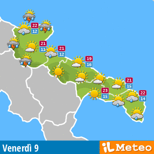
Weather Puglia

Meteo Puglia
Useful information for tourists

Useful information for tourists in Apulia

  • Language:

    Italian

    Currency:

    Euro

    International code:

    0039

    Travel document:

    Identity card for community citizens; passport for extra-community tourists

  • Useful numbers:

    • Carabinieri 112
    • State Police 113
    • Firemen 115
    • Finance Police 117
    • First Aid 118
  • How to reach Apulia:

    By plane

    Bari Airport: Karol Wojtyla. Brindisi Airport: Papola Casale. Foggia Airport: Gino Lisa

    By train

    Trenitalia links the main Italian cities of Apulia

    On highway

    A14 from Bologna through Foggia and Bari to Taranto

    A16 from Napoli; in Canosa it converges with A14.

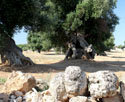
Secular olive-groves with crooked trunks appearing as real natural sculptures.

Secular olive-groves

Symbol of the flora of the whole region is the olive tree, which characterizes the territory from the Tavoliere to the end of the Salento with immense fields.

Secular olive-groves

The olive trees with their beauty and charm, given by their secular crooked trunks, embody the history of Apulia thanks to their millenarian presence on the territory. They are the oldest and largest group of millenarian vegetal specimens in the world.

Self- vegetation and animal species in Apulia.

Horse of the Murgia

A huge number of biotopes of vegetable and animal species characterizes the region, even if only the 7% of the territory has been declared protected area. The Apulian self-vegetation is marked by woods, the Mediterranean maquis and the so-called ganga (rocky pasture).

Pink flamingos in the salt marshes of Margherita di Savoia

The region shows two national parks: the Gargano National Park with many areas and reserves and the lakes of Lesina and Varano, and the Alta Murgia National Park.